Fire Lookouts

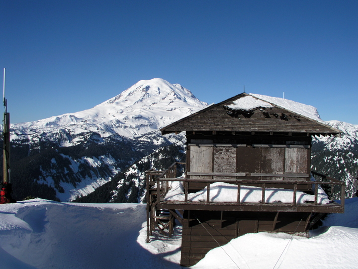
Doesn't this look like a great place to be? It's the Shriner Peak fire lookout on the east side of Mount Rainier, Feb 1, 2007.

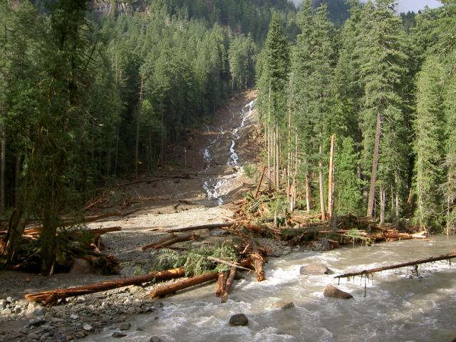
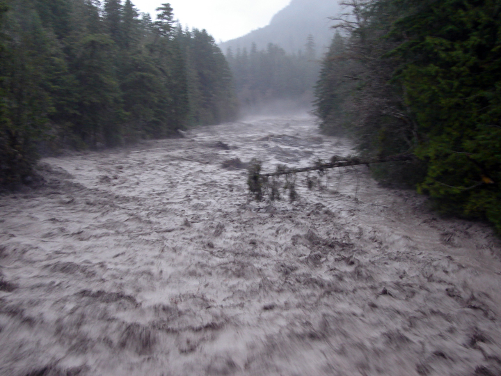
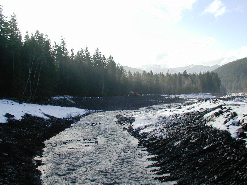
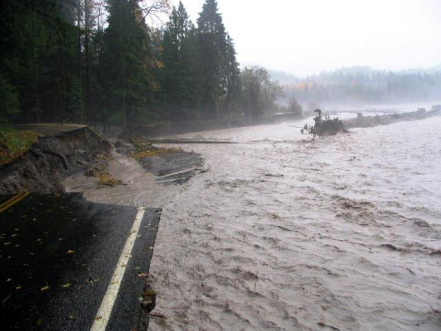
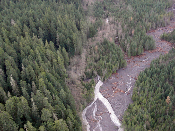
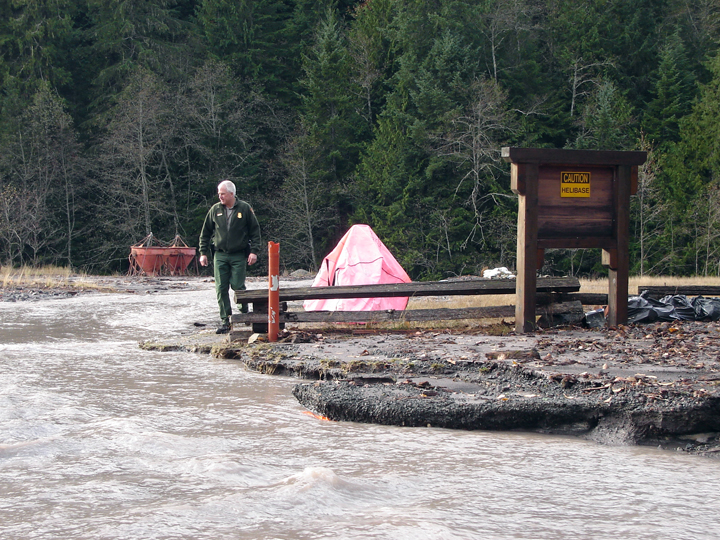
Other fire lookouts around the park, however, aren't doing so well. There were indications of damage shorty after the November rainstorm. The park was flooded, but it was also hit with extremely high winds (particularly on the upper slopes). The weather telemetry equipment at Camp Muir measured an average wind speed of 121 MPH!

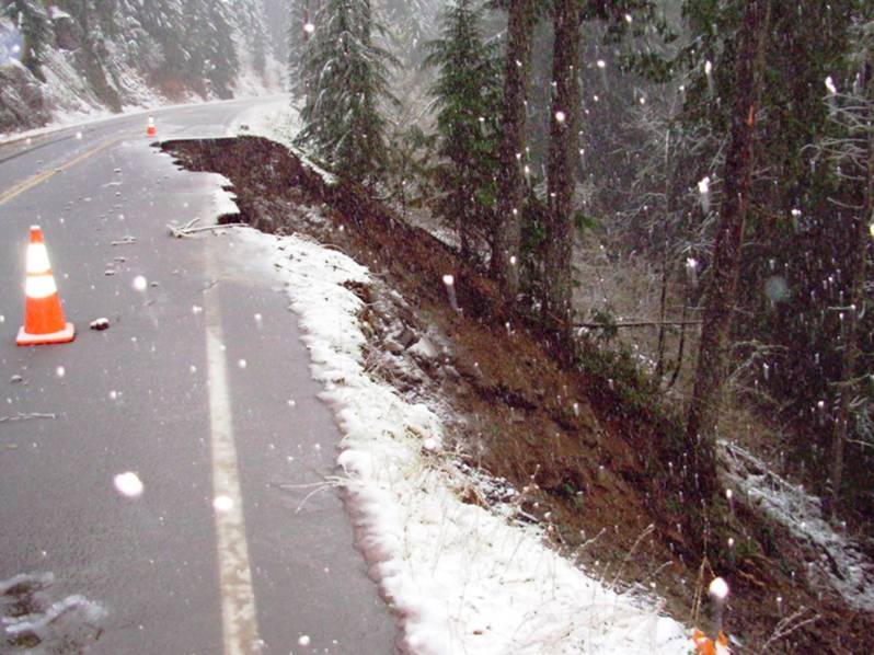
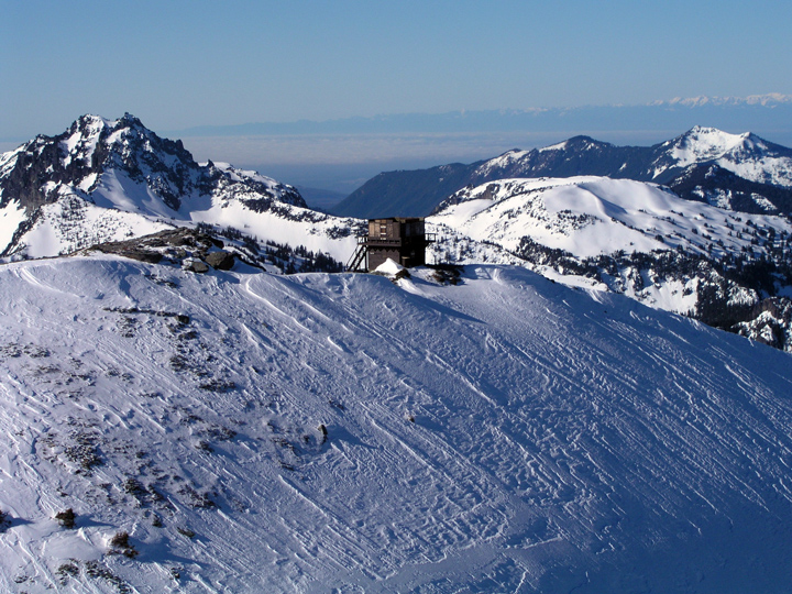
Shortly after the storm, we noticed that certain park radio repeaters were no longer working. Those repeaters happened to be placed on fire lookouts?!. Fremont fire lookout (NE side of the park near Sunrise) was a victim of high winds, and lost it's roof.

.

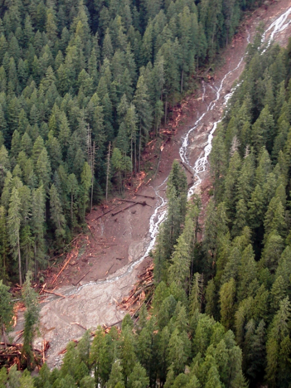
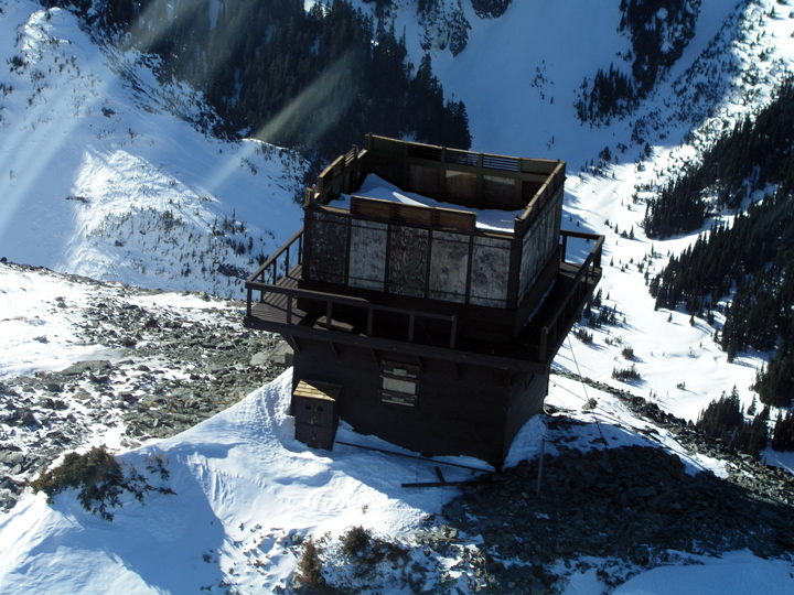
Another aerial image of Fremont fire lookout.

.

.

.


Tolmie Peak fire lookout (NW corner of the park, near Mowich Lake) managed to survive, and it's radio repeater works OK.

.

.


Gobblers Knob (SW corner above Lake George) also lost its roof. This was first confirmed when maintenance personnel took a snow machine up a forest road to "glass" the lookout from outside the park. Once they noted the roof was gone, a team hiked in to closely survey the damage.

For Mount Rainier related images, check out this photo album.

Trail Damage

There was an extensive amount of trail damage associated with flood of Nov 6th/7th and with subsequent other wind storms. Here is the bridge that connects with the Grove of the Patriarchs.


Here is the Wonderland Trail above Ipsut Creek Campground.

.


Here is another section of the Wonderland Trail near the Carbon Glacier.


And if you can image, the Tahoma Creek Trail once existed here...

For Mount Rainier related images, check out this photo album.


Ohanapecosh

A massive mudslide began on Backbone Ridge above Ohanapecosh Campground. It took out the forest and swept down to the river.

Another view of the mudslide from the campground.


The slide began on the road.


.

.

.


Here is an aerial view of the slide.

For Mount Rainier related images, check out this photo album.

Mile Post 5

The Nisqually River swayed dangerously close the main road between Nisqually Entrance and Longmire, near mile post #5. A casual observer might think that the view of the river has been greatly improved.


Upon closer inspection, you can see evidence of road damage. Now, there are cracks in the road that indicate the slope is slumping and sliding below.
.


From the river, you can see the extensive amount of erosion to the embankment.


This is how the engineers intend to repair this one. It will involve a lot of rock and fill.

For Mount Rainier related images, check out this photo album.


Longmire

After 18 inches of rain, Longmire lost it's power and road access. Here is a small selection of images that show the flood, the damage, and the repairs.'


There is bridge in Longmire that makes for a great vantage point during floods. Normally, the upstream view looks like this.


During the storm, the entire river filled to capacity. The river was flowing at an amazing rate, old growth trees slipped downstream with ease, the Nisqually River looked more like the Colorado River.

.

.

Repairing the damage meant heavy equipment in the river. The main priority was to clear all the log jams, and remove excesses debris that had accumulated.

.

.

Here is the Nisqually River near Longmire now that the excavators and bulldozers have done their work. The hope is that during the next flood event, debris will flow more easily through this area.

There are many more pictures of the flood, damage, and repairs here.

Sunshine Point Campground

Sunshine Point Campground and the main park road next to it washed away on Nov 6th. Before the flood, this section of the road felt secluded and dark in the old growth forest. As you can see, the view has significantly improved.


This aerial image clearly shows what was lost. Of the 18 campsites, 12 survived. The access road, parking and restrooms were destroyed.


This image was taken on Nov 7th. The power to Longmire was cut off when the road floated away.


Repairs were swift at Sunshine Point. The rush was on to restore the road and power to Longmire.


On Feb 1st, the first layer of pavement was put down on the road bed. They intend to finish the paving and painting in the spring.

For Mount Rainier related images, check out this photo album.

Kautz Creek

Kautz Creek on the south side of the park jumped its banks quite early during the flood. Many employees in the park drove to work as normal on Nov 6th, only to follow a bulldozer home on the way out that afternoon!

The reason why the creek jumped its banks had more to do with the the amount of rock, mud and trees being carried downstream. That debris exceeded the creek's capacity to carry it. As this debris settled, the elevation of the stream bed rose. This geological event is called aggredation. On Mount Rainier, the average rate of aggredation around Longmire (for example) has been measured at 6-12 inches per year.

As stream beds rise, the water flow natually changes course to lower ground. In this aerial image, you can clearly see where the Kautz Creek jumped its banks and abandoned its original channel.


What resulted was a new creek, that flowed through the forest. That diversion happened about 1 mile upstream from the road. Now, Kautz Creek crosses the Nisqually to Longmire road about 100 yards east of the original bridge. Incidentially, that also happened to be our main road to Kautz Helibase.


More images of the helibase. The repair for this section of road involves more culverts, raising parts of the road bed, and the aknowledgment that the this type of event will mostly happen again.


To handle the current diversion of Kautz Creek, the park decided to to install large (12 foot) metal culverts under the road, that can hopefully handle future flood events. Here is one of those culverts.

To install, they will have to dig a deep and wide cross-section of the main road. This repair will be timely.


For Mount Rainier related images, check out this photo album.