Kautz Creek
 Kautz Creek on the south side of the park jumped its banks quite early during the flood. Many employees in the park drove to work as normal on Nov 6th, only to follow a bulldozer home on the way out that afternoon!
The reason why the creek jumped its banks had more to do with the the amount of rock, mud and trees being carried downstream. That debris exceeded the creek's capacity to carry it. As this debris settled, the elevation of the stream bed rose. This geological event is called aggredation. On Mount Rainier, the average rate of aggredation around Longmire (for example) has been measured at 6-12 inches per year.
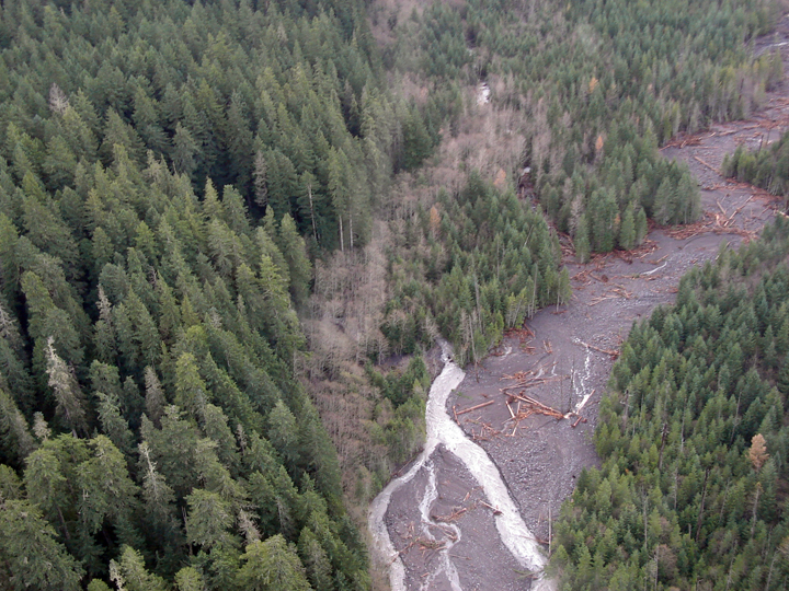 As stream beds rise, the water flow natually changes course to lower ground. In this aerial image, you can clearly see where the Kautz Creek jumped its banks and abandoned its original channel.
 What resulted was a new creek, that flowed through the forest. That diversion happened about 1 mile upstream from the road. Now, Kautz Creek crosses the Nisqually to Longmire road about 100 yards east of the original bridge. Incidentially, that also happened to be our main road to Kautz Helibase.
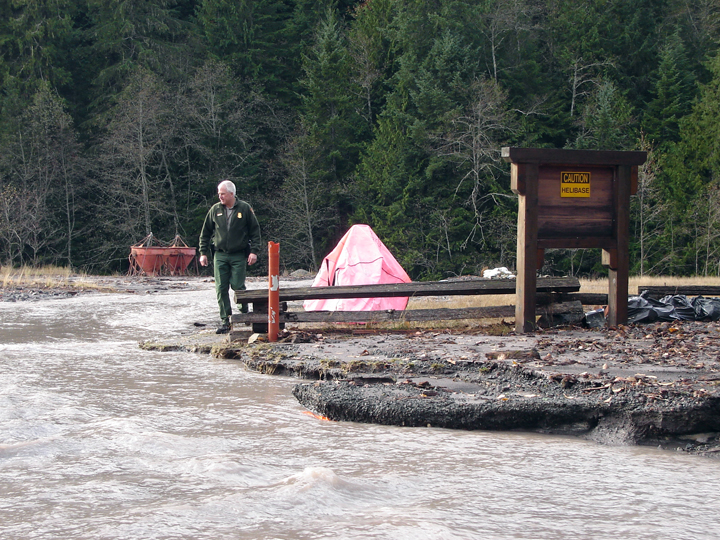 More images of the helibase. The repair for this section of road involves more culverts, raising parts of the road bed, and the aknowledgment that the this type of event will mostly happen again.
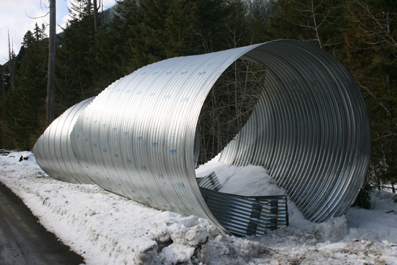 To handle the current diversion of Kautz Creek, the park decided to to install large (12 foot) metal culverts under the road, that can hopefully handle future flood events. Here is one of those culverts.
 To install, they will have to dig a deep and wide cross-section of the main road. This repair will be timely.
For Mount Rainier related images, check out this photo album.
posted by Mike Gauthier at 11:58 PM
![]()
<< Home